Public Art
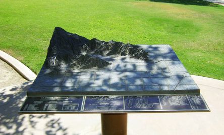
<< BRONZE RELIEF MAP - CITY OF LA QUINTA, CA
(Located at the Campus Park adjacent to City Hall)
This bronze relief map was commissioned by the City of La Quinta to show the City's growth in area since its incorporation in 1983.
Braille labels and raised text provide all information for both sighted and visually impaired visitors. A concrete apron and pedestal base allows full wheelchair access from all sides.
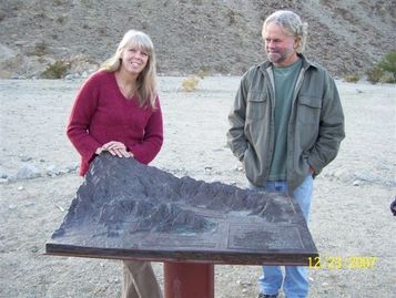
BRONZE RELIEF MAP - COACHELLA VALLEY >>
(Located at the Living Desert, in Palm Desert, CA)
This realistic topographical relief map covers an area of thousands of square miles, from Mount San Gorgonio in the northwest, east to Joshua Tree National Park, south to the Salton Sea, and west to Anza.
All major features are labelled in Braille and raised text, with wheelchair access from all sides.
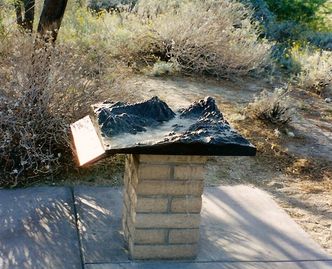
<< BRONZE RELIEF MAP - HIKING TRAILS
(Located at the Oasis Cove Trailhead, in south La Quinta)
This map shows in 3 dimensions the major hiking trails in and near the City of La Quinta. Trails are labelled by name, and the map legend gives one-way distance as well as elevation gain and level of difficulty. Area hikers, mountain bikers and equestrians regularly use this popular map.